Hey everybody,
i’m am trying to load a shp file from Qgis to Sketchup. It works quite well getting the data to speckle form Qgis but when i try to load it into Sketchup, nothing actually gets transfered into the file. Does somebody know what i can do to transfer the data propperly?
1 Like
Hey @DonnyH ,
Welcome to the community. Feel free to introduce yourself if you feel like it.
I am not a Gis expert but I would like to take a look at this geometry. Can you share the shp file and/or speckle stream?
Once we have those, we can look into this matter pretty quickly and see if we can fix it.
Hey gokermu, i’m still quite new to the program so correct me if i’m wrong, i found two links for sharing i asume you need the first one?
1 Like
Yes indeed. Can you also share the shp file?
Yes, This should be one of the files in the branche.
onbegroeidterreindeel (vlak).shp (272.5 KB)
1 Like
Thanks, our SketchUp connector is getting refactored atm. We’ll test it tomorrow and get back to you.
Thank you very much! i’m looking forward to it!
1 Like
Hey @DonnyH ,
@oguzhan and I looked into the issue and found the issue. We’ll try to slide this in the next release. We are doing some major performance improvements on the connector infrastructure. So don’t be surprised if it doesn’t get into this release. We’ll include it in the next release for sure.
2 Likes
Hey @DonnyH,
Thanks for reporting this issue, it is fixed already, but will be available with new release. If you find any other issues, don’t hesitate to report even if it is a trivial issue.
Best regards,
-Oğuzhan
Thank you very much for looking into it and fixing it! Is there a page where i can find the expected release date of new to come releases? Mainly so i would know if the workflow i had in mind with speckle is still doable within my projectplanning or i should find a different way for now.
2 Likes
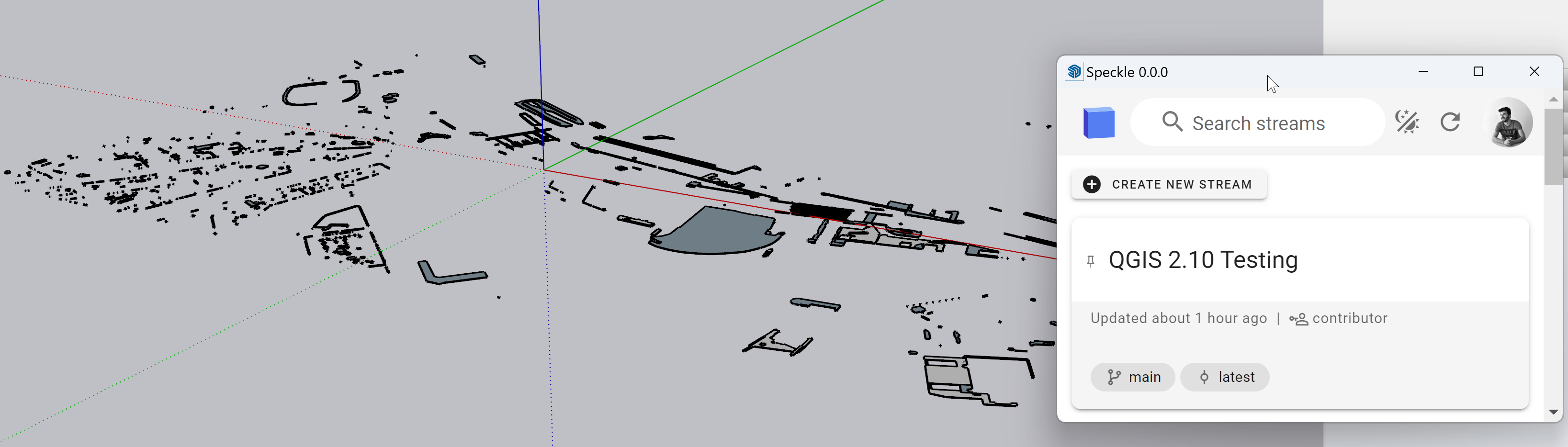
Hy @DonnyH ! I pushed a quick fix to QGIS, you can try sending it from the new version 2.10.2 of QGIS connector
Hey Speckle team,
When I attempt to receive QGIS data from speckle, all I get is a rectangle instead of an expected collection of polygons (Building footprints)
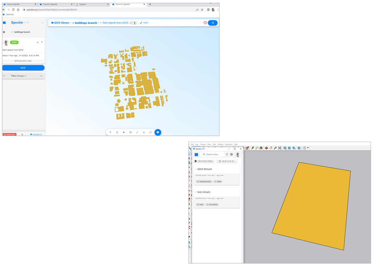
https://speckle.xyz/streams/f3ab1fe0b2
I am on Speckle 2.13.1
Any idea what is going wrong?
ChrisD
1 Like
Thanks for sharing the stream. It’s not clear what’s going on just from there, I will check it out.
Was the QGIS connector also v2.13?
1 Like
Thanks for raising this @ChrisD
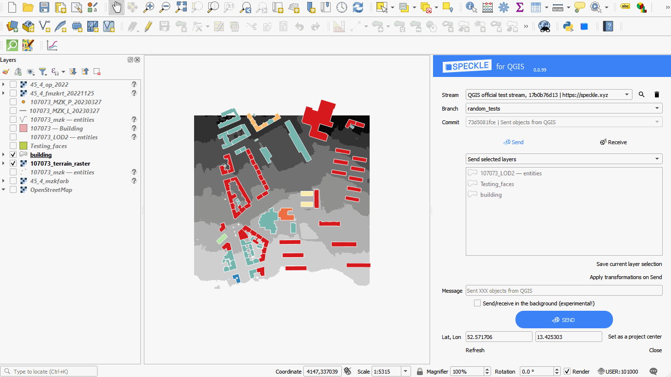
I have been able to get more success by reprojecting the commit to a custom CRS pre-send in QGIS.
But the outcome is not much better—only partial conversions.
I will alert the Sketchup team and see what they can discover.
QGIS to Sketchup is definitely something we’d like to explore more. Can you describe the workflow/use case you are trying to achieve?.. I am guessing, based on others looking to use QGIS to generate site massing models in other software, but I wouldn’t want to put words in your mouth.
You pretty much nailed it. Currently, bringing GIS information into SketchUp for reference or as base geometry to model from can be challenging and Speckle’s QGIS & ArcGIS connectors could allow for streamlined workflows and alleviate some of the workarounds.
CD
1 Like
Understood. I’m running some tests to eliminate if this is a particular case or If there is something in the sending process from QGIS I can tweak; if not, maybe we’re missing support for this specific data shape. We haven’t been testing this workflow GIS->Sketchup so far. We should.
If it requires a fix it will be in a forthcoming release. These are pretty regular.
In either case, I’ll make sure to ping you when there is something to update.
I have uploaded another GIS set. Feel free to check this out in your testing as well.
The download to SketchUp failed completely after many minutes.
https://speckle.xyz/streams/f3ab1fe0b2/commits/f6a1116924
4 Likes
Good news for your case: in 2.14 there will also be a possibility to export 3d buildings based on a “height” attribute ![]()
2 Likes
That is a great feature!!
@Kateryna Will that feature also be available in the ArcGIS connector?
2 Likes
Great question! Unsure, as this is semi-experimental and we might wait for some feedback and fine-tuning before implementing across GIS connectors