Great thanks for the update. Can we expect the QGIS 2.14 update soon?
1 Like
not in my power ![]() I assume within the next month-ish
I assume within the next month-ish
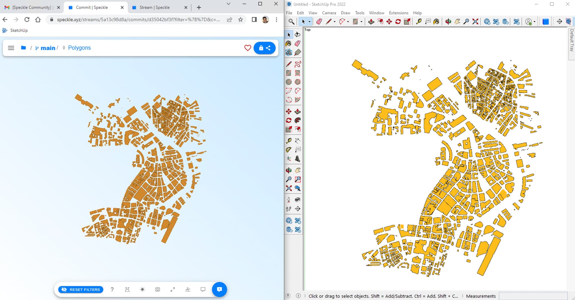
UPD after testing your data:
- The Coordinate Reference system you chose for the project in using feet as units, which will cause the scaling problems later in Sketchup, as all units currently sent from QGIS are treated as meters. Something to fix on our side for 2.14!
- Please check if you can receive both commits in this stream: Speckle . They are sent from the 2.14 (WIP) where the triangulation algorithm has been changed. This could potentially resolve the issue.
Feature enhancement suggestion:
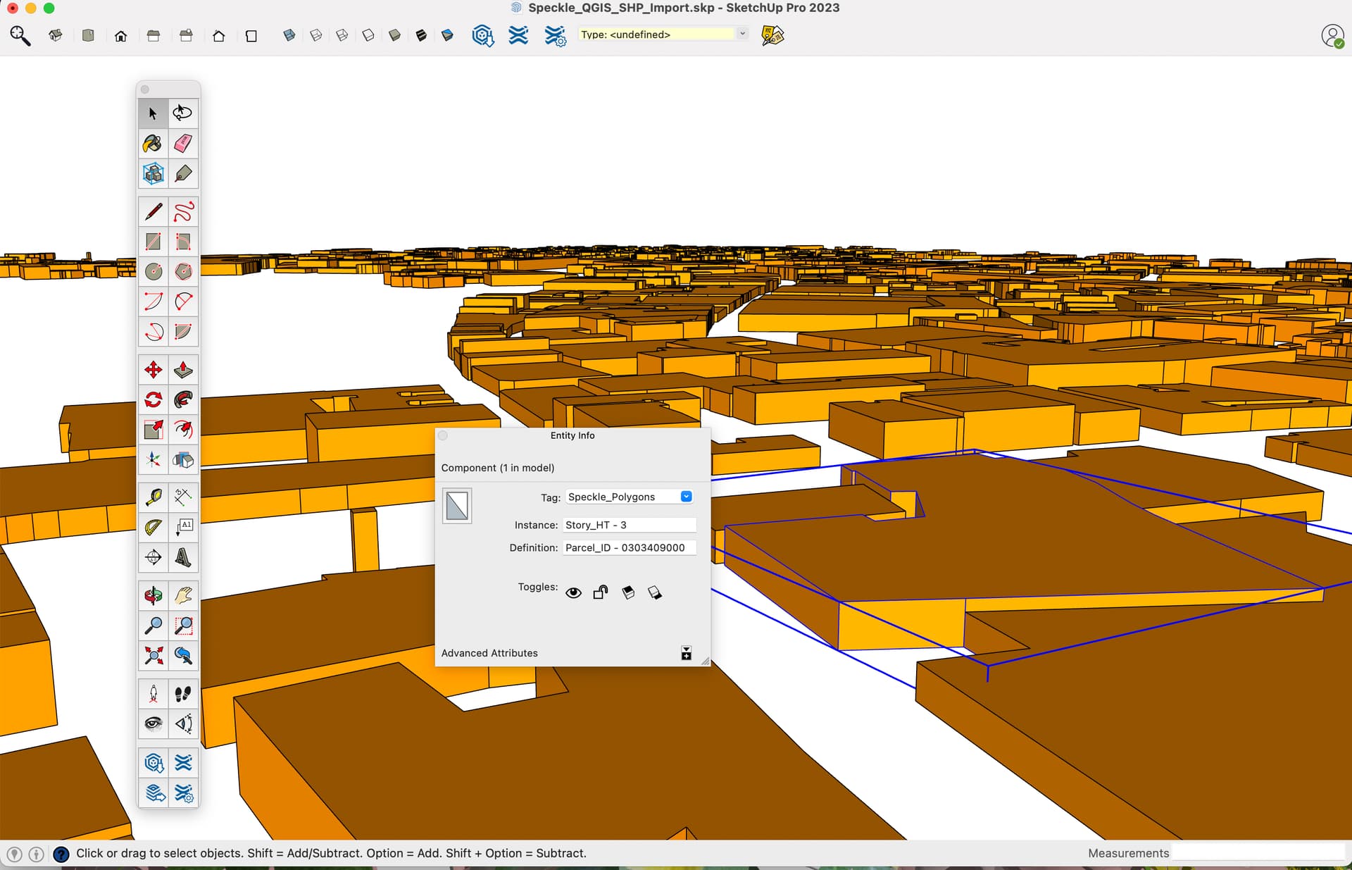
The extruded elements should be generated as individual components or groups with a an instance name specified by the user from the gis attribute table.
Hi @ChrisD,
Thanks for suggestion, we would like to hear more. Can you please give us more context about suggestion with real samples/cases? What you are referring for extruded elements?
When sending elements from QGIS all the attribute table properties should be saved just as before! The extrusion only affects the geometry appearance, the properties aren’t changed
Or, did you mean Sketchup?
I apologize for the miscommunication. This suggestion should have been posted in the SU Connector area. The end workflow result is actually not from the QGIS connector. As @Kateryna mentioned, the GIS data attribution exists in Speckle. The enhancement would be in if/how the SU connector might interpret GIS data/geometry data uploaded to Speckle when downloading into the SketchUp application. Currently the download is raw geometry with no attribution assigned.
@oguzhan
Back in the day, there was once a GIS Plugin for SU that allowed users to access GIS data (shp == polygons, lines and points ) from ArcMap and import it into SketchUp. The result was a collection of SU components that user defined names and attribution based on the shp attribute table.
This allowed planners to filter / find / edit specific pieces of data more easily.
See a mockup image
Cheers
ChrisD
3 Likes
2 posts were split to a new topic: Receiving QGIS Vector/Raster Layers in SketchUp