Just a quick question. is there a way to build the 3D building from its own layer as base?
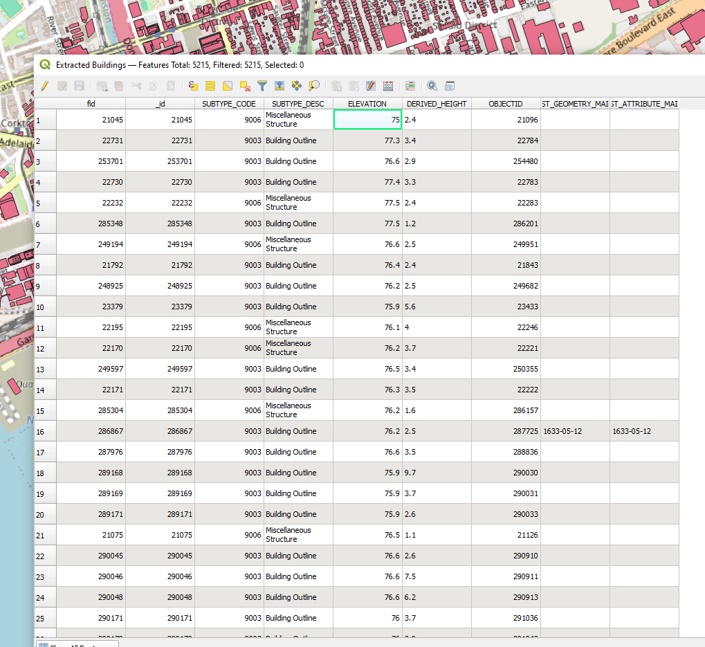
I have buildings that has water elevation plus the height of the building, so i dont really need a topo layer to be based on.
is there a way that i can create the 3D geometry from the elevation point (even better, if for this example, I can set my reference point height as 77m besides the coordinates and angle)
Hi @tjxme !
Interesting question! Firstly, to understand the source data, are your polygon geometries located at 0-m elevation? (just geometry, disregarding the attribute table) If no, you can use Geoprocessing toolbox → set Z value (might be called slightly different), and set your polygons Z coordinate to 0 (or even 77).
If the geometries are flat but you actually want them to be elevated, you can set Z value in the same way, choosing “set value from the field” and point to “ELEVATION” field.
Finally, you can add Speckle “Transformation” to extrude your polygons from whenever they currently are, and choose the field “DERIVED HEIGHT” for extrusion.
Additionally, if you want your building elevation to be correct relative to each other, but adjusted to 77m as “zero level”, just add a New Field in the attribute table, using the Field Calculator formula “elevation - 77”. Then you can use this new field instead of ELEVATION.
Let me know if I understood you correctly, or if the issue is somewhere else🙃
To answer your question, I just used the geojson package I downloaded from the city website, I don’t know if by default they are on elevation or not. My understanding is that by importing the file, they always stick to elevation 0?
Overall, the workflow you gave sounds very promising, but I haven’t test it yet. Will do so next Tuesday when I’m back to work. (Going to watch the solar eclipse anyone? )
yeah most of the datasets will have flat polygons at 0 level, but it’s easy to change
P.S. haven’t heard/prepared for the solar eclipse watching, but feel free to share the photos/impressions
and updates on the workflow:
the set z value did the trick!!! and I also created a custom column as you mentioned to have ‘Elevation’ - 77m
its very awesome to see them on the originated set elevation.