Not sure if I should create a new topic for QGIS everytime - let me know.
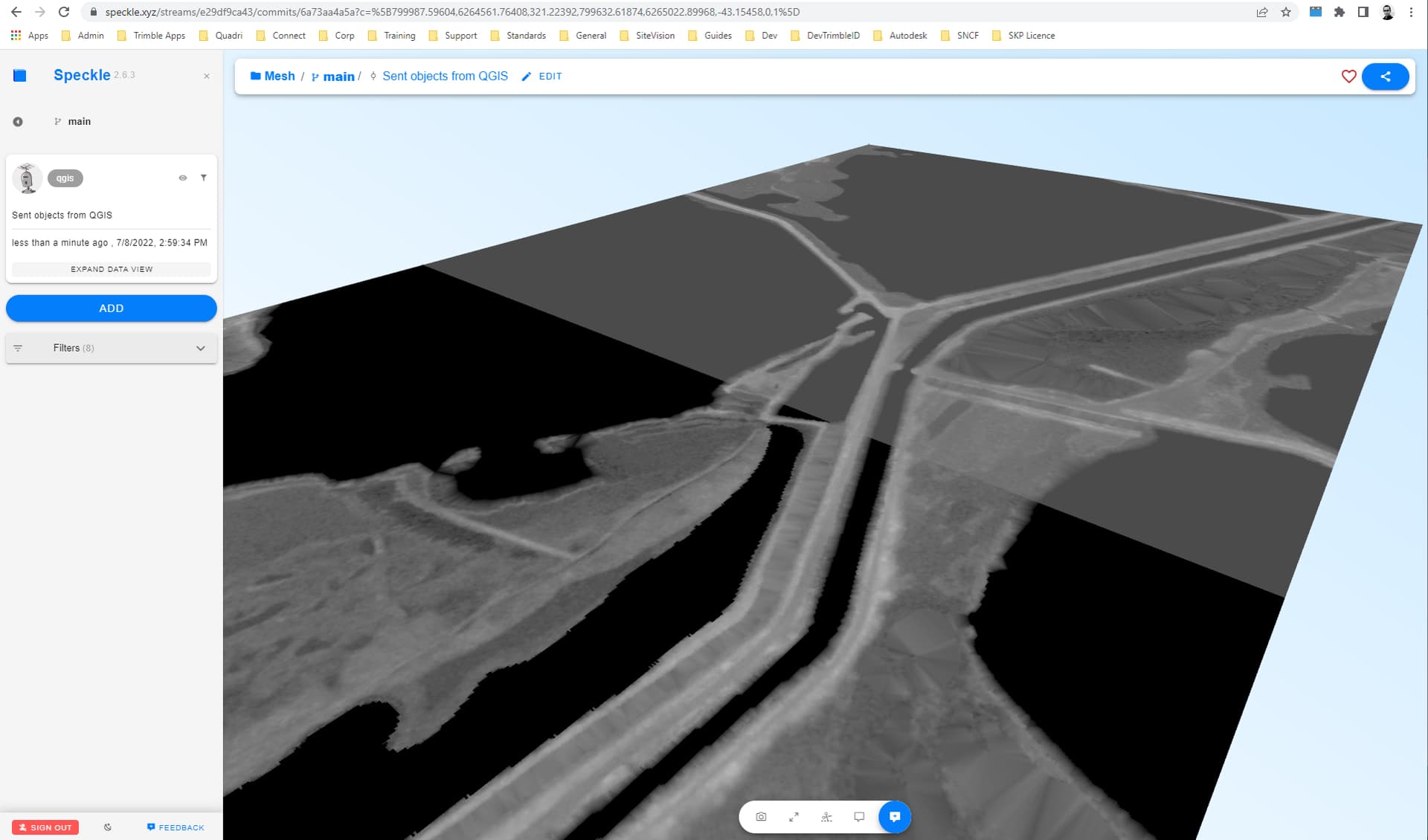
Just tried to send a raster layer to spk. Worked great! This is coming from an .asc file and was wondering if you were considering generating a mesh out of it as well - differentiated with the height values (I am assuming this feature doesn’t exist, if it does… )
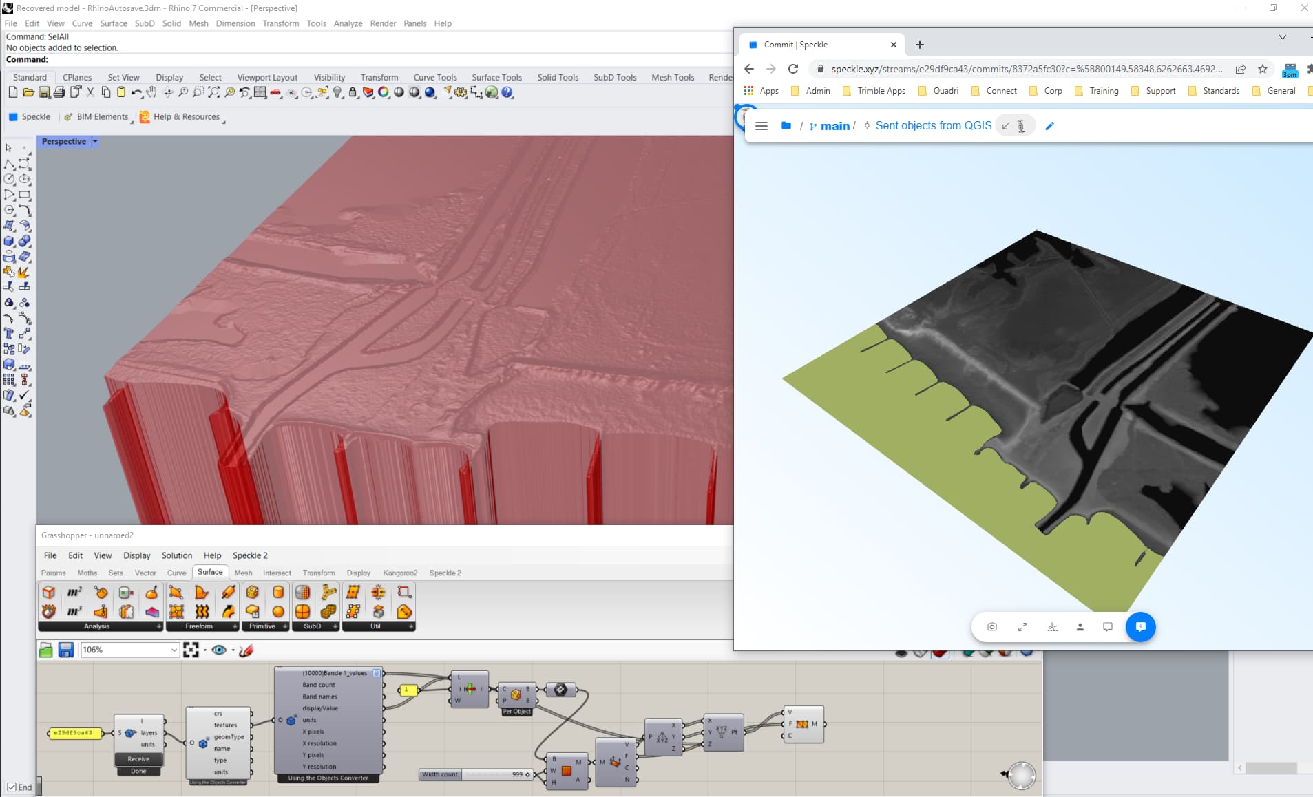
FYI I then tried to send that over to Rhino and the latter crashed
Hey @AlanRynne,
Finally got it working, I guess the first try Rhino didn’t like it
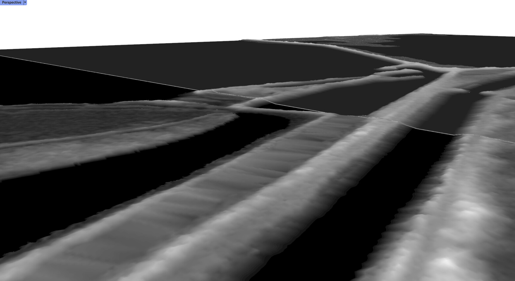
Also managed to process it as a 3D mesh but there are some inconsistencies with image flip/vertices ordering - one of the issues I found is that the vertices count is not the same for Band 1_values (z values) and the display value mesh. Attached you will find the GH def.
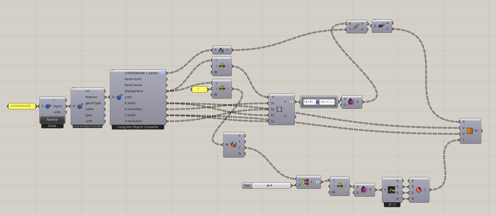
Hi Paul! Generating a 3d mesh with the values from 1 of the bands is entirely feasible! The data is there, color values are being assigned point by point, so adding an extra z-value wouldn’t be hard:) The bigger issue is that, to my knowledge, Speckle connectors are not really doing any geometry transformations in native software, just sending and receiving. So the best guest for solving this, is to advance the connector for QGIS mesh support - the meshes have very straightforward 3d configuration and the export in 3d should be straightforward as well:
And regarding the misplaced values: technically the idea was to have the mesh as a direct representation of Raster from QGIS, and the rest of parameters as well, to be able to recreate the mesh (e.g. in Grasshopper) with any modifications. So you can recreate it as in the screenshot below. The values need to be flipped once though, because QGIS is recording band values horizontally, and Grasshopper is creating grid rows ordered vertically:
Disclaimer about this method: if your selected projection distorts the raster so it’s not orthogonal anymore, it might require a different approach to recreate it in Gh.
Disclaimer #2: “resolution X and Y” parameters of raster are being recorded in the units of selected CRS (by default, meters). But Rhino project can be set to different units, and the “resolution” parameter wouldn’t “know” about it. So you might need to add a scale factor to the resolution. Yes, this is not super convenient approach by now
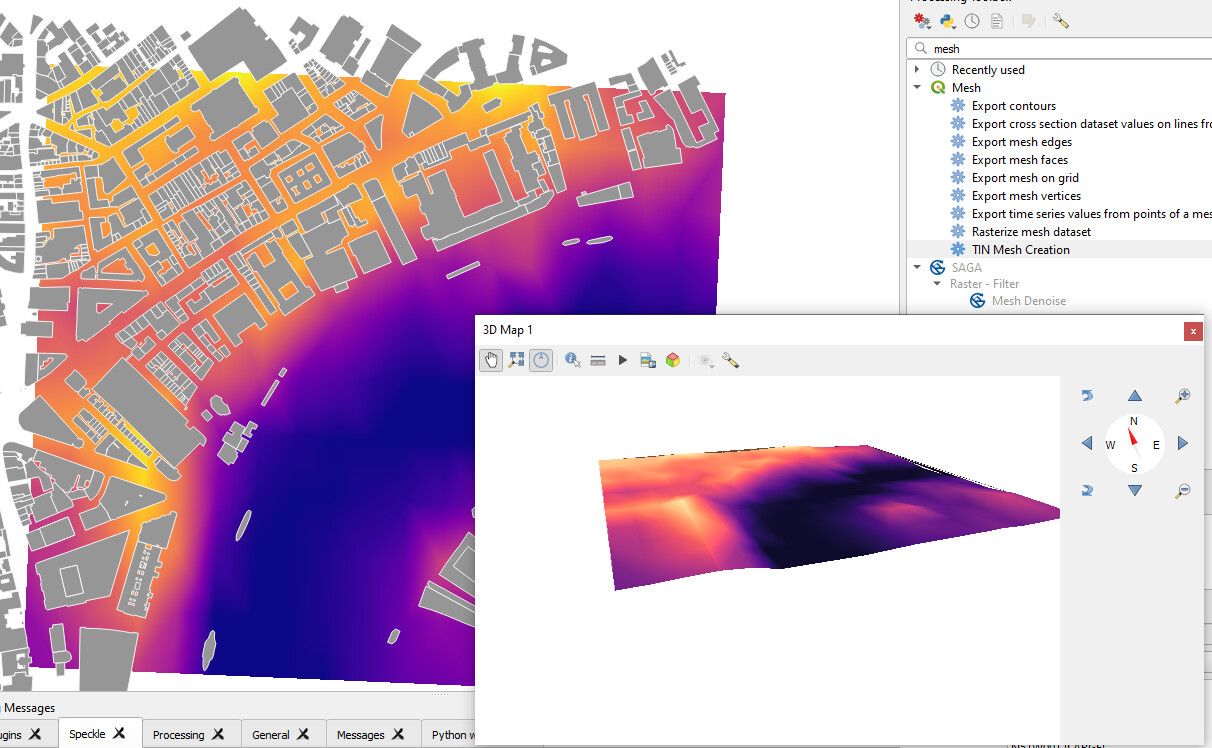
Your method allows for the grid rectangles to be adjusted according to the height - I thought the height values were corresponding the to vertices and not the quad - so I got their centroids to generate a mesh from points. And got the respective colors following this method.
Zooming closer to a zone between two tiles, we notice a gap, because I used the quad centroids to move according to the height value. Not sure how to do it better, if you have any tips…!
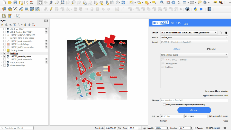
Hey @Kateryna, do you have a stream example showcasing a 3D terrain textured with orthophotos and buildings with custom heights on top? Is the texture kept if sent over to Rhino?
@Kateryna finally got the time to try it.
I’m trying to select the satellite layer as texture (streams from google satellite btw) but I’m unable to select it from the list. Not sure what’s going wrong…
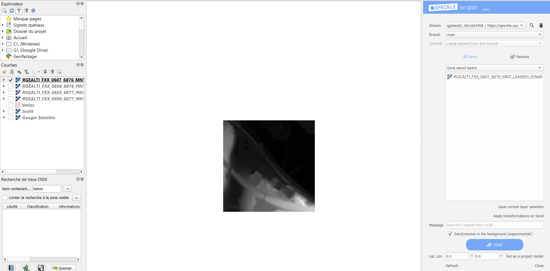
Ok, now I’m trying to send the thing.
When pressing send, the plug-in is greyed out. I’ve been waiting for a few minutes and nothing happens. I’ve attached the mesh I’m trying to send. For now I’m just trying to get it as a 3D mesh without texture. RGEALTI_FXX_0607_6876_MNT_LAMB93_IGN69.asc (5.7 MB)
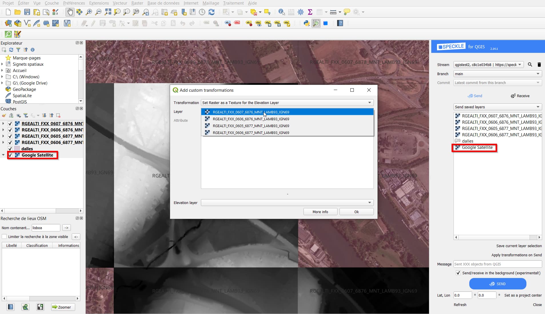
Finally, I’ve made a last test with the texture (“Set Raster as a Texture for the Elevation Layer”)
Unfortunately, the result is still “black and white”, see the same stream posted above.
Am I missing something? see the screenshot below…
Is there a size limit for the raster? My Tiff is 234MB
Hi Paul! Just make sure that you are sending the actual texture layer, not the elevation one (I can see that the elevation layer is selected in the Layers panel)
Hi Kateryna, oh I see, right! I’m currently redoing a test where both are selected. Is that fine, or should ONLY the texture layer be selected? I’ve been already waiting 10minutes for the thing to be sent so I’m wondering if I should really break it or not