Only the texture will be enough🙃 this type of transformation might take a while especially if you have a high resolution of your rasters. You might save some time though, if you save both layers (texture and elevation) in the same CRS, so when the texture is being projected, it wouldn’t need to reproject every single point.
Let a lot of patience come your way ![]()
![]()
1 Like
Finally, I got it to work!
I’ve received it in Rhino. it seems the mesh color is only displayed in Raytraced mode. Did you manage to render it in Rhino Render mode as well?
1 Like
Ok, after some tweaks, got it to render properly.
Seriously, this is so great. Thank you so much for developing this. Having a georeferenced 3D terrain WITH the right texture dropping properly in Rhino, just with a few clicks, it’s just ![]()
4 Likes
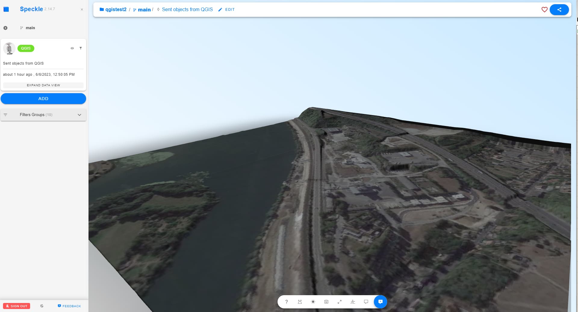
@Kateryna small bug report:
When merging two tiles and sending them as elevation mesh, I get this error
The empty stream: Speckle
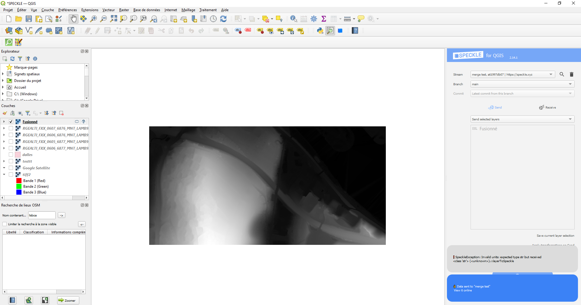
I see! Could you pls open the Log Messages Panel, try to send again and take a screenshot of a more detailed error report from there
It’s weird, I haven’t been able to recreate the issue. Now it’s working… ![]()
Next time I’ll make sure to send the log message
2 Likes
the best kind of issues ![]()
2 Likes
I followed the tutorial video. Upon sending, I get an error message:
Elevation layer is not found. Texture transformation for layer ‘01_satellite’ will not be applied.
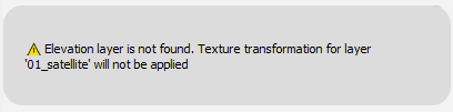
The Speckle stream has no commits.
What did I do wrong?
1 Like
In addition to the tutorial video we have added the Transformations to our documentation: QGIS : Transformations
In particular, please check that the correct elevation layer has been actually been set and applied to the raster data you want to transform - during testing I noticed I would sometimes skip the step to set this properly.
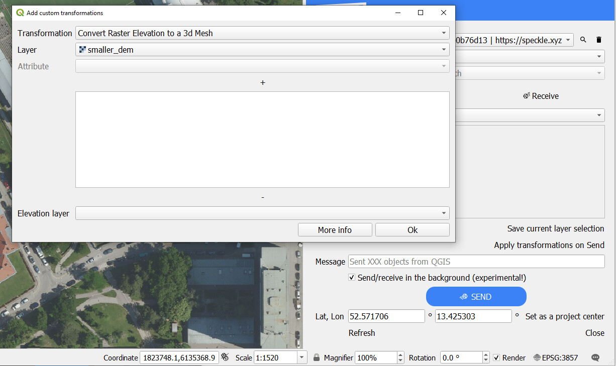
If you think you have followed all the Guide steps correctly, paste screenshots and we’ll see what more we can do to help.
Even if it works second time around let us know any UI improvements you think would help.
1 Like
2 posts were split to a new topic: Creating a terrain from Google Satellite is hanging/very slow